



The Regrid Property App

Description of The Regrid Property App
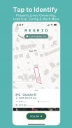
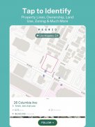
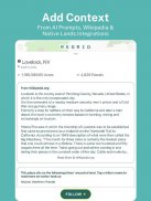
লক্ষাধিক মানুষের প্রিয়, রেগ্রিড প্রপার্টি অ্যাপ হল একটি মানচিত্র-ভিত্তিক সমাধান যা একটি স্মার্ট ফোন সহ যেকোনও ব্যক্তির কাছে জমি এবং সম্পত্তির তথ্যের জগতকে আনলক করে৷ মার্কিন জনসংখ্যার 99% এর বেশি কভার করে 157+ মিলিয়ন পার্সেলের জন্য সহজেই সম্পত্তি ডেটা এবং পার্সেল সীমানা দেখতে একটি সম্পত্তিতে আলতো চাপুন।
নিম্নলিখিত সমস্ত তথ্যে সহজ অ্যাক্সেস (এবং আরও!):
- লট লাইন / সীমানা
- এপিএন/পার্সেল আইডি/রেগ্রিড ইউইউআইডি
- সম্পত্তি ঠিকানা
- সম্পত্তির মালিক
- একর সংখ্যা এবং সম্পত্তির বর্গ ফুটেজ
- বিক্রয় মূল্য এবং তারিখ
- চিঠি পাঠানোর ঠিকানা
- সম্পদের মূল্য
- ভূমির ব্যবহার
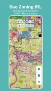
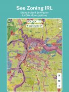
- স্ট্যান্ডার্ডাইজড জোনিং ডেটা
- শূন্যপদ নির্দেশক
বিনামূল্যে, আপনি পাবেন:
- শুধুমাত্র একটি ইমেল ঠিকানা দিয়ে দেশব্যাপী বিস্তৃত পাবলিক রেকর্ড সম্পত্তি সীমানা এবং বিশদ (কোনও ক্যাপ বা সময়সীমা) অ্যাক্সেস করুন
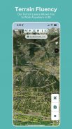
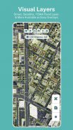
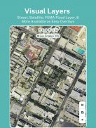
- রাস্তা এবং স্যাটেলাইট বেসম্যাপ টগল
- ঠিকানা বা স্থান দ্বারা অনুসন্ধান করুন
- সহজে ব্যবহারযোগ্য সম্পত্তি মানচিত্র ইন্টারফেস
- আগ্রহের বৈশিষ্ট্যগুলির একটি লিঙ্ক ভাগ করার ক্ষমতা
- সম্পত্তি সন্ধানকারী, রিয়েল এস্টেট টুল, এবং জমির মালিক কে তা খুঁজে বের করার জন্য একটি শিকারী অ্যাপ হিসাবে ব্যবহারের জন্য আদর্শ।
আপনি যদি আমাদের $10/মাসের প্রো প্ল্যানের জন্য সাইন আপ করেন, আপনিও পাবেন:
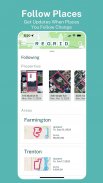
- বৈশিষ্ট্য অনুসরণ করুন: আপনার যত্নশীল বৈশিষ্ট্যগুলির একটি তালিকা তৈরি করুন এবং যখন কিছু পরিবর্তন হয় তখন স্বয়ংক্রিয় আপডেট পান৷
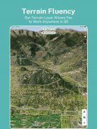
- অতিরিক্ত বেসম্যাপ স্তরগুলি: বিল্ডিং পায়ের ছাপ, উচ্চতা (টোপো) কনট্যুরগুলি সম্পত্তির সীমানার উপর আচ্ছাদিত।
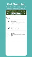
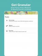
- অঙ্কিত এলাকার রৈখিক ফুট, একরজ এবং বর্গ ফুটেজ গণনা করার জন্য পরিমাপ সরঞ্জাম
- ম্যাপে মালিকের নাম এবং পার্সেল আইডি ওভারলে
এছাড়াও, প্রো আপনাকে আমাদের প্রিমিয়াম ডেটা ক্ষেত্রগুলিতে অ্যাক্সেস দেয়:
- শূন্যপদ
- ভূমির ব্যবহার
- ফুটপ্রিন্ট ডেটা তৈরি করা
- আবাসিক এবং শূন্যপদ নির্দেশক
প্লাস: আমাদের ওয়েবসাইটে, [regrid.com](http://regrid.com) অতিরিক্ত ম্যাপিং টুলের হোস্টে সম্পূর্ণ অ্যাক্সেস। একটি প্রো অ্যাকাউন্টের জন্য সাইন আপ করলে আপনি একই লগইন দিয়ে উভয়টিতেই অ্যাক্সেস পাবেন।


